Mapped areas
Details of the areas HAVOC has mapped for orienteering are shown in the table below. These are specific orienteering maps which aim to show features and contours as well as vegetation details to aid in navigation.
Street orienteering events are often put on using an OpenSource OpenOrienteeringMap, so are not shown separately here. Examples of these can be seen on the MapRun page.
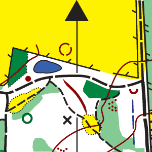
The reference number in the table refers to the corresponding pin on the map.
If you want more details, please contact the HAVOC chief mapper:
|
Name |
Description | What3Words | ||
|---|---|---|---|---|
|
Bedfords Park, Romford |
Parkland with pockets of mature woodland, deer park, small fishing lake, open and rough open areas. |
milk.reveal.parent |
Location Map | |
|
Belhus Woods, Aveley, plus Cely Woods & Belhus Chase |
The country park is a low-lying mix of ancient woods, meadows, streams, ponds and other earth features created by past gravel and brickearth extraction. There are also extensive Forestry Commission and Woodland Trust 1990s tree plantations which are maturing nicely, with their runnability varying with the coppicing and brashing cycles. The area is relatively flat and fast for those who can maintain map contact while making frequent decisions caused by the path and ditch network and the mosaic of woods and meadows. |
audit.grand.quest digit.owls.polite |
Location Map | |
| Dagnam Park, plus The Manor & Duck Wood | ruins.vine.sing | Location Map | ||
|
Epping Forest South West, Chingford |
Mature forest with mainly deciduous trees and some holly bushes. To the south west there is the open area of Chingford Plain with its grass land and thickets, as well as a model aircraft flying area. Further to the east lies Connaught Water, a haven for wildfowl. Over the years, with successive thinning of parts, the area has become more runnable. There are a number of horse rides in the area and a network of smaller paths, some are minor while others are well used by walkers and mountain bikers. |
choice.sparks.monkey belts.tuck.chairs |
Location Map | |
| Folkes Lane, Upminster | rungs.bolts.reach | Location Map | ||
| Hadleigh Country Park, Benfleet/Hadleigh |
The area consists on a south facing scarp slope, steep in places, with flat drained marshland at its base. New paths and biking trails, which criss-cross each other, have been created in the area. The marshland, part of the Thames Marshes, is crossed by the Fenchurch Street to Shoeburyness railway line. The terrain includes mature and younger woodland with open and rough open areas on the steep hillside running down to the more open flat, rough grazing areas which are interspersed with ditches, some containing deep water. The grazing areas have been extended to other parts of the park resulting in a number of new stock fences, topped by barbed wire, having been built. There has been some clearance work, the newly cleared areas have been mapped as rough open. Unusual for Essex, this is a good opportunity for some hill training. The Country Park is on the western side of the area and the eastern part was used for the London 2012 Mountain Biking event and has been developed to include several mountain bike routes and activities as part of the Olympic legacy. Some old WWII buildings can be seen in the eastern part. |
grapes.love.point strain.email.test |
Location Map | |
|
Hart's Wood, Brentwood, plus Donkey Lane Plantation and Little Warley Common |
Terrain is a mix of established woodland and parkland |
tinsel.dart.snail |
Location Map | |
|
Havering Park, Romford |
spits.sung.plug |
Location Map | ||
| Hornchurch Country Park, Hornchurch, plus Ingrebourne Hill, Berwick Woods and Glades | On the site of the former RAF Hornchurch, this country park has a mixture of ecological interest as well as heritage. The area has been landscaped with blocks of woodland, lakes, open and rough-open areas. A mountain biking trail has been created along with a horse-ride in the south-western part of the area, known as Ingrebourne Hill. There are surfaced and unsurfaced paths throughout the park. Some structures from the RAF days can still be seen including pillboxes and Tett turrets. To the east is the Ingrebourne River and its flood plain which is a haven for birdlife. Further east are the Berwick Glades and Woods. The former is a relatively newly planted woodland and the later the site of old gravel workings much of which is overgrown by scrub. |
lion.calm.friend insect.chips.plus mint.sing.even |
Location Map | |
|
Langdon Hills, Basildon |
The terrain is a patchwork of mature woodland, open and semi-open areas, along a ridge of hills overlooking the Thames estuary. The longer courses will include rural tracks between the main areas of woodland, and will involve significant climb (for Essex). |
shower.sprint.guides rock.sadly.await month.asks.shower |
Location Map | |
| St. Faiths, Brentwood | Location Map | |||
|
Thorndon Park South, Brentwood |
Thorndon Park South is a mixture of ancient and re-planted woodland, streams and a lake, open meadows and pasture fields with some steep slopes and contour detail. Ancient woodland is very runnable. 1990s Woodland Trust plantings have now matured into pleasant woodland. |
edges.pram.focus |
Location Map | |
|
Thorndon Park North |
Thorndon Park is an area of established mixed woodland with some open and semi-open areas and a good path network. Longer courses go into the southern area of fields and more recently created woodland. Unfortunately, as with many other areas, there are numerous small paths created by mountain bikes. |
settle.baked.knee chair.only.sounds |
Location Map | |
|
Weald Park, Brentwood |
Terrain is gently contoured and comprises undulating mature woodland, a deer park, lakes, landscaped open and rough open areas. |
snack.stale.hiding oval.bind.shakes blaze.food.saints |
Location Map | |
| Pages Wood, Tylers Common, Tylers Wood, Harold Court Woods and Harold Wood Park |
using.meant.warm moved.sizes.freed |
Location Map |