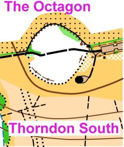
Thorndon South Colour Coded
Herongate, Brentwood Essex
Sun 30th Sep 2018
Type of event: Regional
Type of terrain: Parkland, Woodland
League: SWELL, ESSOL
Results
Info
This event incorporates the first round of the 2018/19 SWELL (South & West Essex Local League) season plus a round of the ESSOL schools competition.
We welcome CHIG (Chigwell & Epping Forest), DFOK (Dartford) and SOS (Essex Stragglers) Orienteering Clubs for their respective club championships.
The event is open to all orienteers and suitable for newcomers.
Location
/0.3553069219481131,51.58432331463659,12/500x400?access_token=pk.eyJ1IjoicGF1bGZyb3N0IiwiYSI6ImNrenZxN2s0YjZvMGIybm8xaGNxb3ltYXYifQ.dl7YKehDTCGbfoxMRiVe7g)
Nearest town: Brentwood
- Grid Ref: TQ634898
- Postcode: CM13 3LH
- Latitude: 51.58432
- Longitude: 0.35531
- Google Map (aerial)
- Bing Map (OS)
- OpenStreetMap
Directions / Parking
From the M25 J29 junction: Take the A127 east for 3 miles. Turn north at the A127/A128 junction towards Brentwood; after a quarter mile turn left into the country park indicated by a brown and white tourist sign. (OS Grid Reference TQ 634898 Postcode CM13 3LH)
The car park is hard standing or on well drained grass areas. There is a tiered Essex County Council "Pay and Display" charge: upto 1hr £2.20; 2hrs £3.30; 3hrs £4.40 or over 3hrs £5.50 (coins and cards accepted), you will need to enter your car registration number before paying.
Public Transport:The nearest railway station is at West Horndon, 3 km to the south: half-hourly service from Fenchurch Street. There are no local bus services on a Sunday.
Event registration will be next to the car park.
Facilities
Toilets adjacent to the west end of the car park; unfortunately the cafe is currently closed.
Start and Finish within 200-300m of the car park.
Other attractions: Lake with wildfowl and a barbecue area.
Terrain Description
Thorndon Park South is a compact mixture of gently sloping established and re-planted woodland, streams and a lake, open meadows and pasture fields, with some steeper slopes and contour detail
Registration & Start Times
Registration 10:00 am to 12 noon.
Starts 10:15am to 12:30 pm.
Courses close 2.30 pm.
Course Information
A range of colour coded courses, White to Blue. There is a Light Green but no Short Green as the area has insufficient detail to support the more technical course. Provisional course information is given below:
| COURSE | DISTANCE | CONTROLS | |
| WHIITE | 1.7K | 12 | Easy - Junior beginners |
| YELLOW | 2.5K | 14 | Fairly easy - Junior improvers, adult beginners |
| ORANGE | 2.9K | 12 | Moderate - competent juniors; adult improvers |
| LIGHT GREEN | 3.9K | 13 | Fairly hard - experienced juniors; competent adults |
| GREEN | 4.8K | 15 | Experienced orienteers |
| BLUE | 7.5K | 21 | Experienced orienteers |
Courses will be suitable for beginners, improvers and experienced orienteers. Help and coaching will be available for beginners/improvers (please ask at Registration). Maps will be overprinted on waterproof paper. Loose control descriptions will be available from Registration.
Entry Details
Seniors £7 (£2 surcharge for non-British Orienteering members.)
Juniors £3.
Electronic punching will be used at this event – SI ‘dibber’ hire fee 50p.
Pairs and groups pay one senior fee only but should take only one map.
Contacts / Officials
Planner: Doug McTurk (HAVOC)
Organiser: Colin Jackson (HAVOC)
Controller: Paul Beckett (HAVOC)
Dogs allowed?
Not permitted on the courses because of livestock. Dog exercise circuit around the grass field south of the car park.
Safety and Risk
A comprehensive risk assessment will have been carried out by the organiser, but participants take part at their own risk and are responsible for their own safety during the event.
Privacy: when entering our events your name may appear in the results section of this website or in newspaper reports.
Read our privacy policy to see how we look after your personal data.